

Landslide Causes in the Walla Walla Watershed
Hard
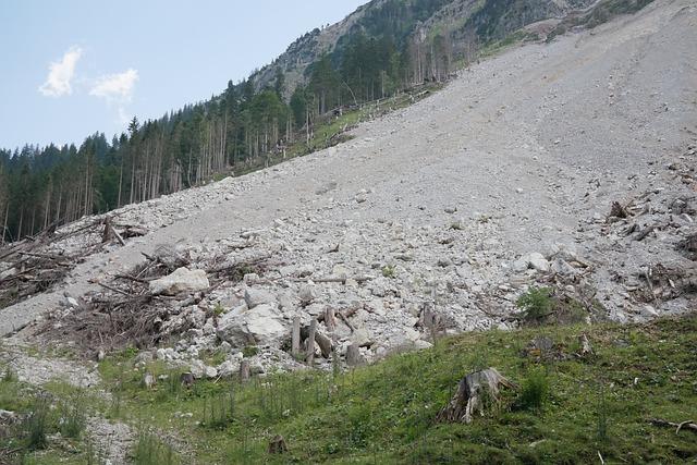
What happens to streams when hillsides collapse and dump sediment into the water? In the Blue Mountains of Washington, landslides send soil into rivers that salmon depend on.
This study inventoried nearly 250 landslides in the Touchet subbasin. Each site was mapped from aerial photos and then checked on the ground. Slope angle and slide size were recorded along with probable cause.
The results show that 59% of slides happen in stream channels. Natural slides account for about 25%. Roads built for logging cause most of the human-triggered slides at 11%.
Hypothesis
The hypothesis is that land use activities, such as agriculture, livestock production, mining, outdoor recreation, and timber harvesting, can destabilize hillslope soils and cause landslides.
Science Concepts Learned
Landslides
When large masses of rock and soil slide down a slope, they can reshape entire watersheds. A study in Washington’s Blue Mountains inventoried nearly 250 landslides in the Touchet subbasin — mapping sites from aerial photos, then confirming each on the ground. The results are striking: 59% of slides happen in stream channels, showing how gravity-driven debris flows concentrate along the very waterways that salmon depend on.
Method & Materials
You will complete a landslide inventory of the Touchet subbasin of the Walla Walla River Watershed. You will use a combination of 1:24,000 scale orthophotos from 1996 and aerial photographs to locate nearly 250 possible landslides. You will then transfer the sites to a topographic map to be used for field reconnaissance.
You will need a GPS receiver, a range finder, a clinometer, and a topographic map.
Eureka Crate — engineering & invention kits for ages 12+ — monthly projects that build real-world skills. (Affiliate link)
See what’s includedResults
The results of the inventory showed that the greatest percentage of landslides (59%) occurred in stream channels, while 24.8% were natural landslides. Of human-induced slides, roads were the largest cause at 11%. The landslides related to timber harvesting totaled 2.6%. It is clear that land use activities can destabilize hillslope soils and cause landslides.
Why do this project?
This science project is interesting and unique because it provides an opportunity to learn about the causes of landslides and the effects on aquatic ecosystems.
Also Consider
Experiment variations to consider include studying the effects of landslides on other aquatic ecosystems, such as lakes or rivers, or studying the effects of landslides on other types of wildlife, such as birds or mammals.
Full project details
Additional information and source material for this project are available below.Related video
These videos explain the science behind this project and demonstrate key concepts used in the experiment.
Share this Science Project:
Browse by Grade
Related Science Fair Project Ideas
Bury bones across a soil-filled fish tank, shake it like an earthquake, and measure which ones shift the most.
Hard
Drill a one-meter soil core with an auger and map each layer by its color and texture.
Hard
Drag a brick with an elastic cord and watch a vibration sensor record the stop-and-go jolts that mimic earthquakes.
Hard
Share this Science Project: